800x500.png)




SNOW AND SLEET POSSIBLE AHEAD OF AN ARCTIC COLD FRONT
- ncwxauthority

- Nov 12, 2019
- 2 min read
Snow and sleet have already started across the mountains, accumulations are possible here. The National Weather Service has issued a Winter Weather Advisory for the Mountains and adjacent Foothills, a possible brief changeover to snow could happen across Central NC later this afternoon (Don't get your hopes up). Record Cold is expected behind the front tonight and Wednesday.
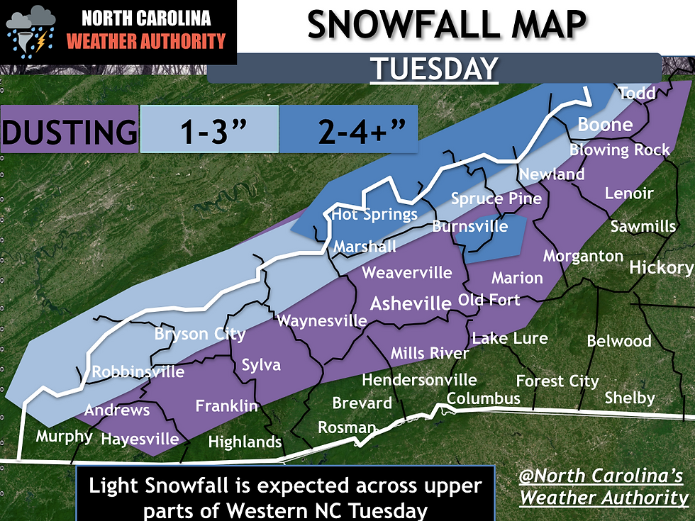
MOUNTAINS: Accumulating snow likely for the mountains, as a strong arctic cold front moves in it will bring some snow to the Mountains and adjacent Foothills on Tuesday. Everyone in the Mountains will start as rain and then transition to snow by mid-morning. Gusty winds will help drive a northwest snow event by afternoon and evening. Accumulation will be light, mostly confined to elevations above 3,500ft and the smokies/ high country boarding Tennessee. 1-3 inches possible along the TN/NC border with more elevated amounts (2/4") on the highest peaks (Grandfather, Mount Mitchell, and the Smokies) Flakes to up to a 1-2 likely elsewhere from Asheville to Boone.

The first Winter Weather Advisory of the 2019-2020 snow season has been issued image 3, the following counties are under a Winter Weather Advisory: Alleghany-Ashe-Avery-Madison-Yancey-Mitchell-Swain-Haywood-Buncombe-Graham-Northern Jackson-Macon-Southern Jackson-Transylvania-Henderson- Watauga.
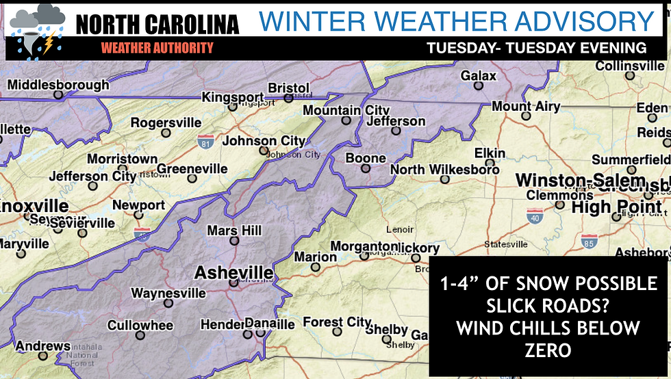
IMPACTS...Plan on slippery road conditions developing by late Tuesday morning, and possibly lasting into Wednesday morning in some areas. The hazardous conditions could impact the morning and evening commutes.
CENTRAL NC
Mostly rain is expected over the Triad and Central NC, but a change over to snow for a brief period of time is possible to about Raleigh. Anafront is when a very Arctic air mass arrives, which is a specific type of a cold front; this type of system is tough to forecast. When the cold air catches the snow it is extremely hard to figure out. This type of event will not bring significant snowfall to Central NC; you need the cold air in place first. Tomorrow we will not have cold air in place first. Cold air mass starts to undercut the precipitation just enough to turn it into the snow at the very end of the precipitation passage; this is very hard to do. These events usually don't work; however, the rain could change over to snow for a short period in the red hatched box. At best some minor accumulations on the grass.
Here's a look at the timing of the "possible changeover" don't get your hopes up outside the mountains.

I'll have more updates on Facebook, Stay tuned for updates on North Carolina's Weather Authority Facebook throughout the week and beyond! Thanks for the support!


Comments