Forecast Wednesday, June 5th
- Ethan Clark

- Jun 5, 2024
- 1 min read
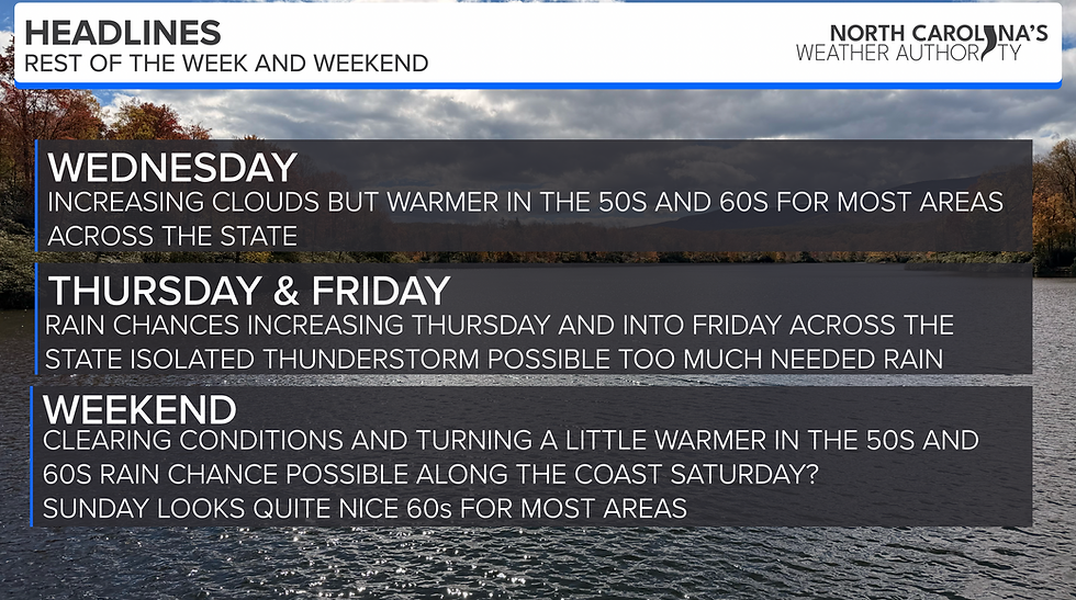
Good morning; let's make it a great day! Happy Wednesday, North Carolina! As I look over the surface and radar observations, there are a few showers and even a thunderstorm out there across the state. At the surface, a bermuda high pressure will continue to be in control of our weather, allowing for good afternoon heating. There is a trough moving across parts of the MS valley and southern Plains which will move to the east over the day. Models do a poor job with developing storms today, but I still expect more scattered popup showers and thunderstorms this afternoon and evening; an isolated severe storm can't be completely ruled out, mainly a damaging winds threat. Partly sunny skies are expected today with highs in the mid-upper 80s to around 90° in most places; it'll be hot and humid again today.

I expect more showers and thunderstorms on Thursday ahead of a cold front; an isolated weather threat could exist. We will see some cooler and drier weather for the weekend. Have a good day.


Comments