

NORTH CAROLINA MOUNTAINS TO SEE A WHITE CHRISTMAS AS A WINTER STORM MOVES IN TONIGHT
- ncwxauthority

- Dec 24, 2020
- 2 min read
WHITE CHRISTMAS?
SNOW AMOUNTS INCREASE FOR THE MOUNTAINS: Dreaming of a White Christmas, head to the mountains. Accumulating snowfall is expected tonight through Christmas across the mountains of NC; this will be a northwest snow event. Temperatures will be hovering just near to slightly below freezing; this will lead to accumulating snow from Thursday night into Friday. Wind blowing snow is expected due to high wind gusts.
Accumulation: 1-2 to 3-5 inches expected for anyone above 2,000ft; some snow will even fly for the valleys (Asheville). The big winners for snow are above 3,500ft into the Smokies and along the North Carolina Tennesse border 4-8inches like along the highest peaks, for example, the Smokies mountains, Mount Mitchell, the western facing ski resorts, and Blue Ridge Parkways. A few ridgetop locations will exceed 8+ inches, especially in the Smokies. Snowfall amounts are highly dependent on elevation; the higher you are, the better. The lower you are in the valleys, light snowfall possible.

A Winter Storm Warning is posted for Avery-Madison-Yancey-Mitchell-Ashe-Watauga-Swain-Haywood-Graham-
A Winter Weather Advisory is posted for Swain-Haywood-Buncombe-Graham-Northern Jackson-Macon- Southern Jackson-Caldwell Mountains-Burke Mountains-McDowell Mountains-Cherokee-Clay
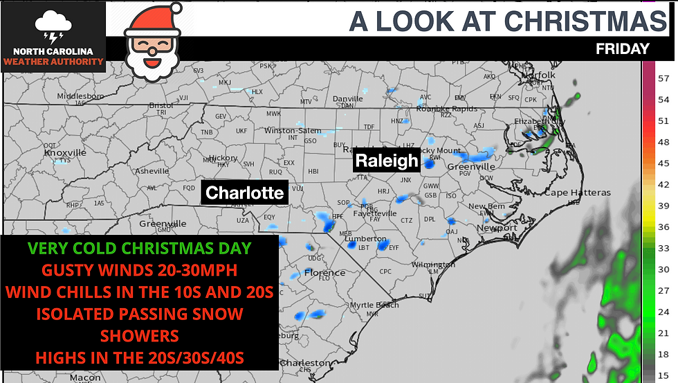
While areas outside of the mountains will not see a white Christmas. It is very possible tomorrow during the day, there is a few snow flurries or passing snow showers across the state, no accumulation possible. Snow on Christmas is very rare, but I can't rule out about a 20% of a few isolated snow showers statewide tomorrow.
Regardless, it will be very cold with highs in the 20s/30s/40s across the state; once you factor in the wind chills, it will be in the 20s and 30s for most. Mostly sunny skies with an isolated passing snow shower; it will be cool to see a few passing if we do.


Comments