


Forecast Wednesday May 6th.
- Ethan Clark

- May 6
- 1 min read
A new day is ahead, it'll be a changing one. Happy Wednesday, North Carolina! We will see partly to mostly cloudy skies for most of the state this morning into midday. A few scattered showers will be around the west, with an isolated passing shower into Central NC late morning to around lunch; otherwise, quiet. Highs will warm into the 70s and 80s for most of the state, with cooler temps to the west thanks to more clouds and some rain around. A cold front will move into the state later today, this will set the stage for scattered showers and thunderstorms acorss the mountians and foothills later this afternoon and into the overnight hours. There will be some bursts of heavy rainfall at times, a couple of storms could have gusty winds and an isolated strong to severe storm risk will be around.
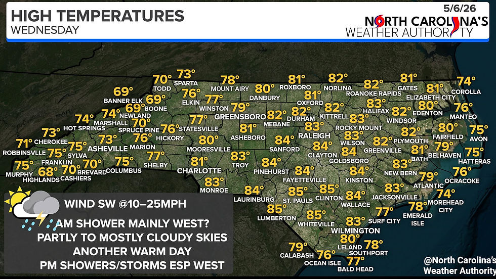
Most rain chances will be west today, with the greatest chance across the mountains and foothills, with the heaviest rain across the South to southwest parts of the Western parts of the state. We will watch rain/storm chance push east overnight into Thursday in a more scattered setup. I'll have more thoughts on that later today.
-Ethan


So pleased to see your email on my iPad this morning, appreciate all you do for all of us that watch your site and keeping up with the new season starting up. Thank you. Thank you. Thank you.!