


The Day 31 Tornadoes Hit North Carolina
- Caden Nelson

- Apr 6
- 3 min read
Since reliable records began in the early 1950s, North Carolina has had their fair share of tornadoes. The difference between here and Tornado Alley? You don't see them coming. Tornadoes in North Carolina, as compared to Texas, Oklahoma, Kansas, Nebraska, Iowa, and the Dakotas, are often rain-wrapped and obscured by trees and terrain - making them much harder to see and take action.
The 2011 Severe Weather Outbreak
April 16, 2011
On Saturday, April 16, 2011, much of the eastern seaboard, but North Carolina in particular, was preparing for what would become a significant and deadly severe weather day.
The Setup
April 16th was the final day of a 3-day severe weather setup.
Beginning on Thursday, April 14th, a strong storm system in the Rockies moved east, over the central and southern Great Plains during the afternoon and continuing east over the mid and lower Mississippi River Valley during the overnight hours.
The National Weather Service Storm Prediction Center (NWS SPC) had issued a Moderate Risk of severe weather for eastern Oklahoma, Arkansas, Kansas, Missouri, and Texas. A dryline had setup across Oklahoma by the afternoon, which is where thunderstorms initially developed that would eventually turn into a line of supercells shortly after development (around 4:00 PM CDT).
A dryline is one of many weather boundaries. In this case, this boundary separates moist areas (usually from the Gulf) to the east and dry, hot desert air to the west. These are often found in the Plains during the spring and summer. It acts as a trigger for the development of thunderstorms. |
Numerous funnel clouds and tornadoes were reported by storm chasers and local emergency management. There were two fatalities and 43 people injured in Tusha, OK from a large, intense tornado. In Arkansas, at least 7 people were killed as a result of straight-line winds and a weak tornado embedded in a squall line.
A squall line, otherwise known as a Quasi-Linear Convective System (QLCS) is a line of strong to severe thunderstorms, usually consisting of heavy rainfall and strong winds, but short-lived, weak embedded tornadoes are also possible. |
Another Moderate Risk was issued across Alabama and Mississippi for April 15th, day 2 of the severe weather outbreak. Numerous large and extremely dangerous tornadoes were spotted across the Deep South, including Jackson, MS, which prompted Tornado Emergencies to be issued by local National Weather Service (NWS) offices. There were at least 7 fatalities from the storms on April 15th.
It was then time for the Carolinas and southern Virginia. Soundings across NC showed a high CAPE (Convective Available Potential Energy) and a high shear environment, which points towards a very significant severe weather day. CAPE tells us how much "fuel" is in the atmosphere for thunderstorms and shear is what storms need to develop tornadoes. This isn't just a tornado setup - this is the kind of environment that can produce strong, long-lived supercells. As a result, the NWS SPC issued a very rare High Risk for severe thunderstorms across southern VA, and central and eastern NC. This High Risk was the first issued in 2011.

Tornado Watch
At 12:05 PM, the National Weather Service Storm Prediction Center (NWS SPC) issued a rare Particularly Dangerous Tornado (PDS) Tornado Watch 150. This watch included central and eastern North Carolina, central and eastern South Carolina, southern Virginia, and coastal waters.

The NWS SPC warned the public for the following threats:
Numerous tornadoes, including some intense tornadoes likely
Scattered damaging wind gusts of 70 MPH likely
Scattered large hail up for 2 inches in diameter
A squall line moved towards the I-77 corridor, rapidly intensifying as it moved off to the east. As the line moved east, it produced the first of many tornadoes - Salisbury (EF 1), Monroe (EF 0), and just north of Burlington (EF 1). The Burlington tornado would then lift and eventually produce additional tornadoes near Roxboro and South Hill, VA.
As the squall line rapidly moved off to the east, the line began breaking up into discrete supercells, which was quite possibly the worst case scenario.
At around 3:15 PM EDT, a Tornado Emergency was issued for an intense tornado in the Raleigh-Durham metro. At one time the tornado had been a high-end EF 3, damage in Wake County was between EF 0 and EF 2.
A total of 31 tornadoes touched down across the state. There were 24 fatalities and 446 people injured as a result of this severe weather outbreak.
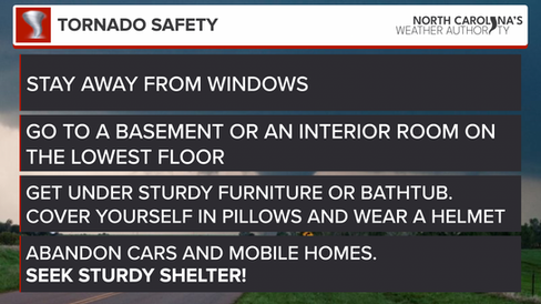
Severe Weather Preparedness
While outbreaks like April 16, 2011 are rare, tornadoes in North Carolina, for the most part, are not. And because many of them are difficult to see, preparation becomes critical.


Comments